|
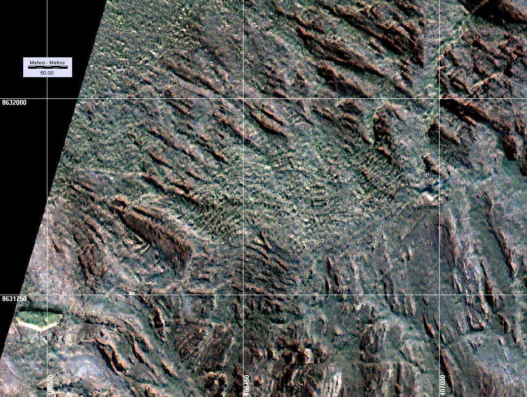
Imagen QuickBird
georeferenciada de las imponentes ruinas de Huamanmarca a más o menos
4000 metros sobre el nivel del mar. Las ruinas abarcan más o menos 3
hectáreas y están cubiertas por vegetación por situación de abandono.
A la izquierda abajo hay lo que parece ser un gran reservorio de 60 m de
largo.
.
==> Haga click sobre la imagen para ampliarla.
.
.
QuickBird
georeferenced satellite image of ruins of Huamanmarca at about 13,500 feet above
sea level. The area covered by the ruins is approximately 7 and a half
acres. They are covered by vegetation due to lack of maintenance.
At bottom left can be seen what appears to be a reservoir of about 200
feet long.
.
==>
Click on image to enlarge.
Published by
permission from
ARPL Tecnología Industrial S.A.. Lima, Peru
Gentileza de ARPL Tecnología Industrial S.A. |
|
 |