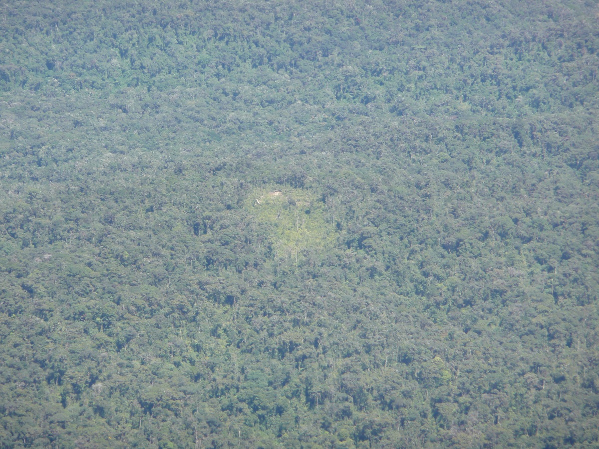
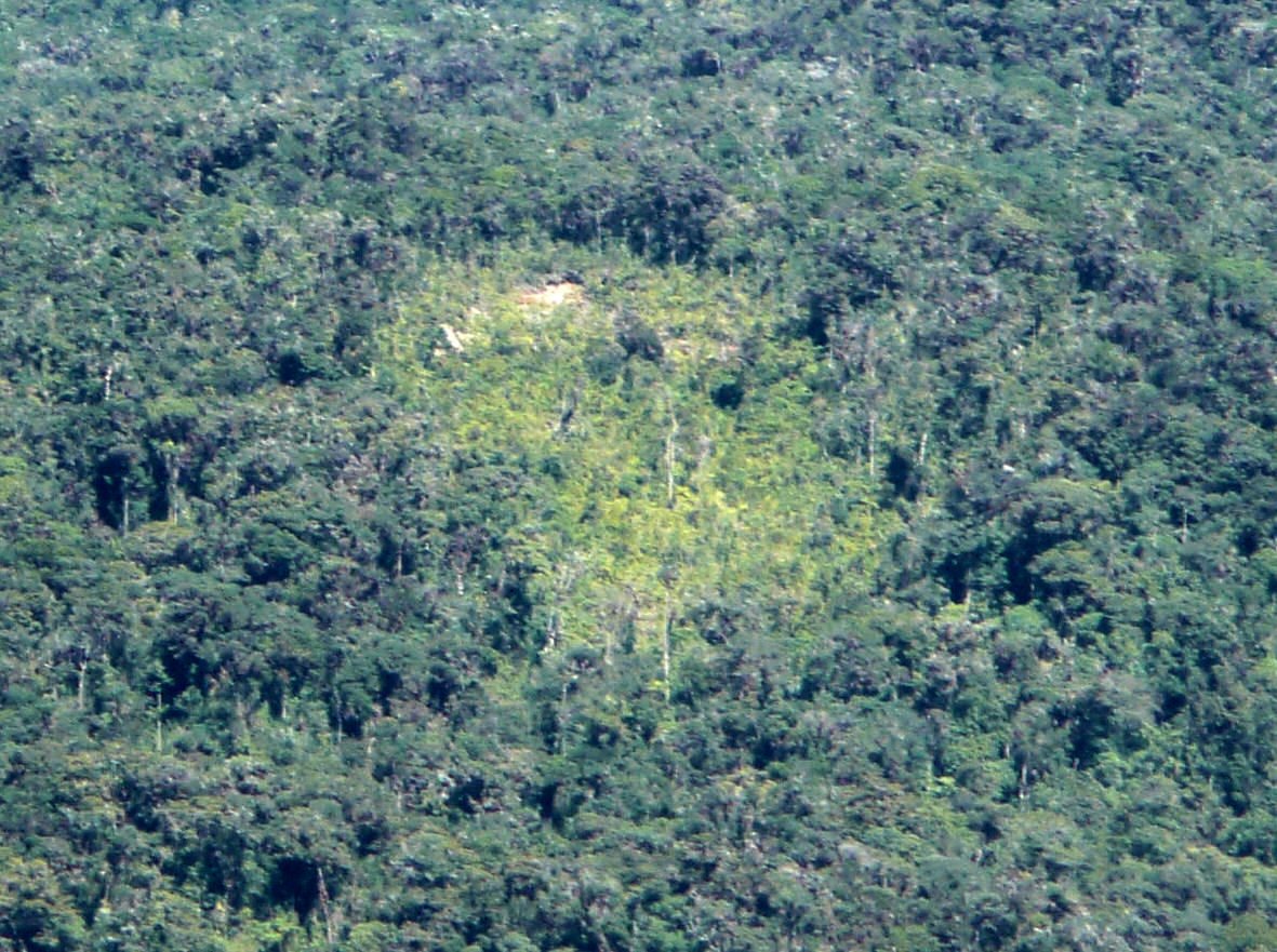
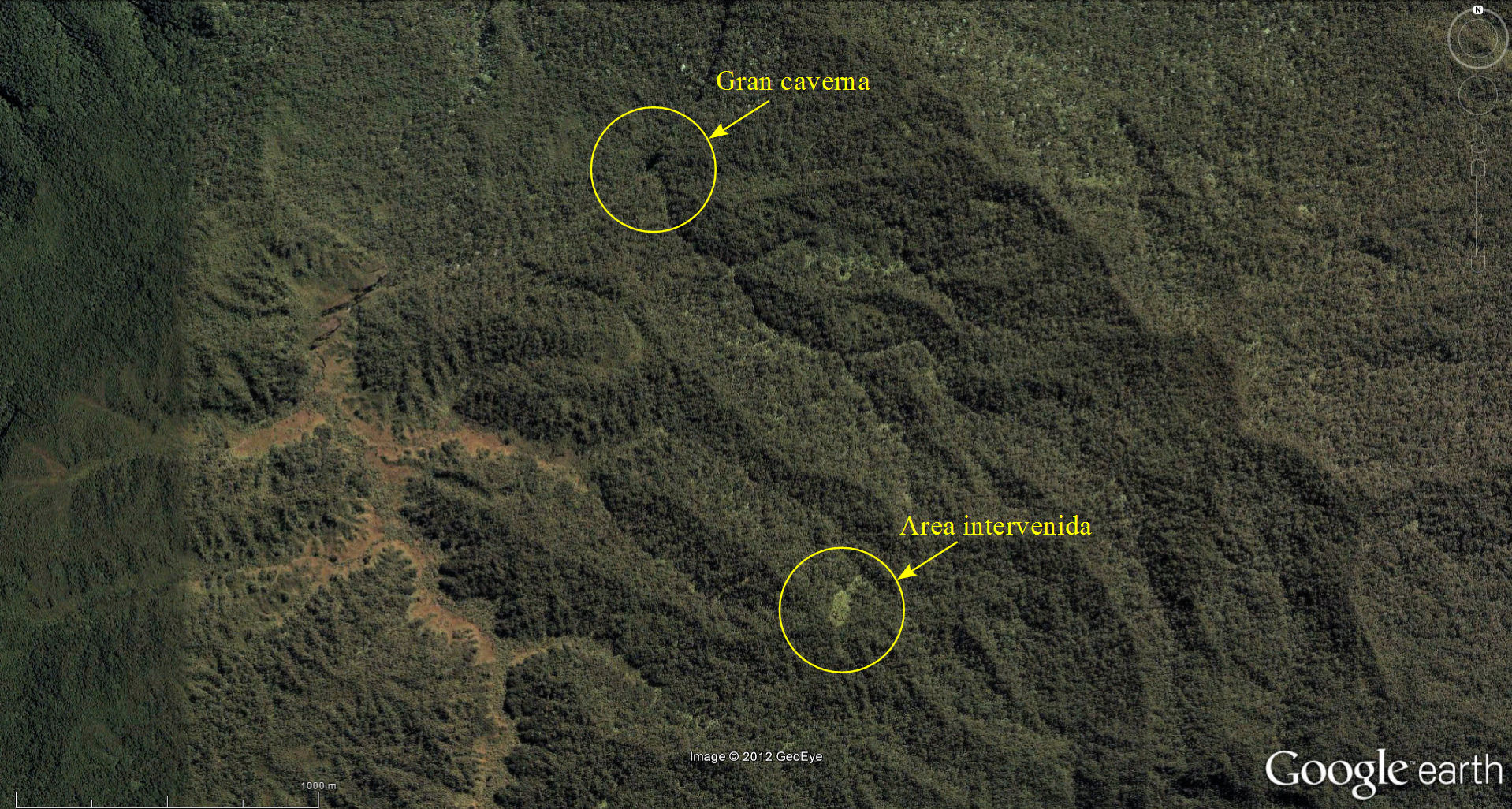
Less than 2 km from a newly found cave (Image 1) there is a plot of about 100 meters long by 50 meters wide which reveals recent human activity as is clearly shown in Image 2. This image is part of a June 2008 image taken by the Czech forestry specialist Petr Nemec on a flight over the plateaus of Otishi National Park. This plot and the location of the cavern can be seen in an image taken from Google Earth (Image 3) showing part of the geographical context in which it is located. The GPS clock synchronization with the clock of the digital camera used in the picture allowed us to locate the plot quite accurately on the map of Google Earth. The plot is located at an altitude of approximately 2700 meters above sea level, an unusual altitude for Ashaninka natives.
 |
 |
| Image 1: Large Cavern | Image 2: Plot showing recent human intervention (enhanced) |
 |
|
| Image 3: Location of the plot showing human intervention | |
The intervened area is located at approximately 1550 meters from the large cave, which is located downhill at about 2560 meters above sea level. On the other hand, the area contains no other sign of human intervention, or typical huts that would be visible in the satellite images of Google Earth which in that area are of high resolution.
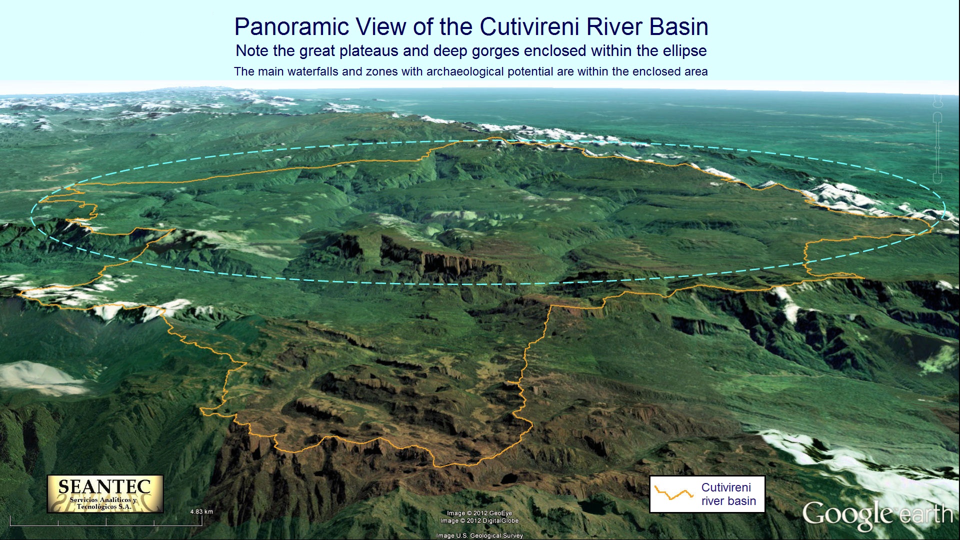
The virtually inescapable conclusion that we are arriving to, based on the evidence presented, is that the people who have created this plot are currently living underground in one of the cave systems that exist in at least three of the great plateaus of the region. It is noteworthy that the six large plateaus of the region are entirely within the Cutivireni river basin area, which is practically unknown to the vast majority of Peruvians. All this leads us to think that there may be an uncontacted population in the region. We have no way of knowing the origin of this possible underground population, but it is likely, however remote it may seem, that it may be related to the Inca population which under the leadership of Manco Inca rebelled against the Spanish invasion in 1535, fleeing precisely this direction, to the northwest of Cusco in the Cordillera Vilcabamba. This hypothesis may seem fantastic, but in any case should be thoroughly investigated. The foundation of this hypothesis is that, because of the unknown and difficult terrain of this region which was for the first time was mapped correctly in the 1960s (1), peruvians were never able to investigate with the necessary geographical and historical rigor what really happened with the creators of the Inca culture, whose magnificent works of architecture and engineering are admired worldwide. On the other hand, interest on the myths of the "Lost City of the Incas" (2) is an additional motivation to thoroughly examine this issue. Today there are technologies such as geographic analysis used in this report that may help in the search for truth.
Further reading: Article published in the book "The Nature and Culture of Latin America. Review of Polish Studies", Cracovia, 2010 (link). A preliminary version of the article, originally drafted in 2007 can be found in http://www.peruvia-gallery.com/geography/index.html (see the chapter on "Archaeological Potential ").
Lima-Perú, January, 2013, translated from Spanish to English and updated, March 2016.